Infrastructure appears to have taken the brunt of losses inflicted on the Telangana economy by some of the severest floodings on view during the last week and into early this week on account of a roaring monsoon, according to an analysis by RMSI, a leading player in geospatial and engineering solutions.
Khammam worst-affected
The infrastructure sector will drive the economic loss the State suffered during the floods with at least 80,500 buildings having been impacted, says Pushpendra Johari, Senior Vice-President, Sustainability at RMSI.
Intense rainfall created havoc in 15 districts impacting potentially 84,000 km of the road network; 12,232 km of power transmission network; 1,755 km of railway tracks; and 325 telecommunication towers, he told BusinessLine in a post-event analysis of the event.
Khammam is the most affected district, with 9.80 per cent of its area experiencing flooding; however, infrastructural damage has been most widespread in Bhadradri-Kothagudem, with the town of Bhadrachalam suffering the worst.
“Incessant rainfall caused heavy runoff feeding more water to the rivers and reservoirs in both Telangana and Andhra Pradesh. The flow level breached their carrying capacity,” Johari said.
Worst in 32 years
It was after 32 years that the Godavari was witnessing floods of this scale. The water level was above 71 feet in the early hours of Sunday before receding to 60.20 feet at 6 pm the same day. Some villages, however, are still flooded and will see marginal relief only when the water level drops below 43 feet. Many villages in Dummagudem and Cherla mandals and some colonies in Bhadrachalam are reported to be submerged.

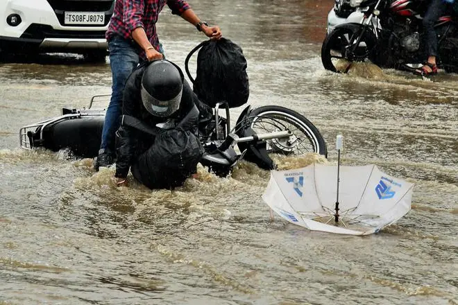
A motorist who fell in a pothole at Madhapur after rain water covered the roads into lakes at Madhapur in Cyberabad on Friday, July 22, 2022, is helped by a passer-by as day long rain lashed Hyderabad and Telangana. (NAGARA GOPAL / The Hindu)
The unprecedented rainfall badly affected the residential, commerce, industrial, transportation, and utility sectors alike.
“We have modeled this impact analysis based on RMSI’s proprietary flood model and our in-house exposure data for Telangana. We have analysed different exposure elements affected due to rainfall-induced flooding in the state. A total of 143 PIN codes have been affected across 15 districts of the state,” says Johari.
Rain pattern in catchment
RMSI analysed the actual rainfall July 14-21 over the Godavari catchment to understand the rainfall pattern. The districts of Kumuram Bheem, Adilabad, Nirmal, Nizamabad, Jagtial, Peddapalli, Jaya Shankar Bhupapally, Mulugu, Medak, Kamareddy, Allluri Sitharama Raju, Rajanna and Warangal Urban and Rural experienced heavy rainfall while the Adilabad and Nirmal districts accounted for the maximum accumulated rainfall ranging between 300-350 mm, the analysis said.
Severe flooding events
Bhadrachalam in Kothagudem district and Chennur in Mancherial experienced severe flooding around the river bank. Kothagudem district saw severe flooding, with around 35 km of the railway line, 12 km of bridge network, 713 km of transmission line, and 4,060 km of road length affected.
Mancherial experienced widespread impact with 1,011 km of road length; 76 km of transmission lines; 47 km of railway track; and 4 km of bridges on the affected list. Flood waters flowed to a height of an estimated 4.5 m and above the maximum level in Bhadrachalam. In Chennur, the estimated flood flow depth ranged from 3.5- to 4.5 m, RMSI said.


Comments
Comments have to be in English, and in full sentences. They cannot be abusive or personal. Please abide by our community guidelines for posting your comments.
We have migrated to a new commenting platform. If you are already a registered user of TheHindu Businessline and logged in, you may continue to engage with our articles. If you do not have an account please register and login to post comments. Users can access their older comments by logging into their accounts on Vuukle.